
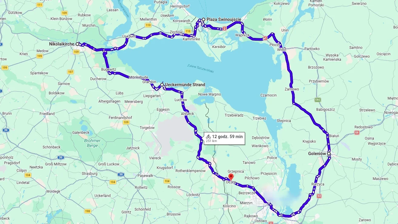
When I need to clear my head, I get on my bike. Two years ago I came up with a route that fits into one sentence: out to the sea through Germany, home through Poland. Start and finish in Dobra, just outside Szczecin, with two overnight stops and a full loop around the Szczecin Lagoon.
It came to about 300 kilometres in three days, more than I had ever covered on a single trip. I managed to pack a tent, food and water, so that part was sorted. The sleeping bag was another matter: I simply forgot it. It was early September, so the nights in the tent were cold, but I had a fleece and somehow got through.
Three days around the lagoon
On the first day I left Dobra and turned west after crossing the border, towards Ueckermünde. From there I followed the Szczecin Lagoon to Anklam, where I stopped for the first night after roughly 80 kilometres.
On day two I headed from Anklam towards the coast, and there was time for a swim in the sea along the way. At Świnoujście I was back in Poland, but still had the ferry across the Świna and the ride to Goleniów ahead of me. That was where the second stage ended, the longest of the three at about 120 kilometres.
The third day left about 50 kilometres from Goleniów back to Dobra, which closed the loop. Three days earlier I had only known the route from a map. Now I had ridden all of it.
A night beside a church
I spent one of the nights in a tent on the grass beside a church. Travelling with a tent, though, you do not get a shower that easily, and sooner or later you need a proper freshen-up. The plan was a full wash at a swimming pool, but that day, as luck would have it, the pool was closed. I ended up having breakfast at McDonald’s, where I could at least wash my face and brush my teeth. On a three-day ride, questions like these come up alongside the route planning: where to stop, where to sleep and where to get a wash.
Wind, rough tracks and navigation
Out on the road it was bloody windy, and Google Maps kept sending me along terrible roads, across fields and through forests. Covering the distance was one thing; doing it on those surfaces was another. The kilometres were taking their toll, and at some point I stopped following the suggested route.
I started reading the map and choosing the road myself. The difference was immediate: the ride became much easier. The phone still helped me work out where I was, but I no longer left it to decide which way I should go.
Despite the wind and the rough tracks I made it back to Dobra, and I handled the whole trip, my longest bike ride at the time, surprisingly well.
If I did it again, I would plan the route in Komoot, an app made with cyclists in mind, rather than in Google Maps. It was the navigation that added most of the needless rough tracks. I would also pack the sleeping bag, although that one goes without saying.